Paris Brest Paris 2015

Tomorrow I depart for France to ride Paris-Brest-Paris. My frame number will be E034: rider 34 in the 80hr limit, starting wave E, at 17h00. You can follow me via the official rider tracking: http://suivi.paris-brest-paris.org/E034.htmlIMG_1832

As much as I’m excited about PBP, I’m even more excited about returning to France. And, unlike my last two trips, this time for more than just a few days. Before the ride, I don’t plan to do much: eat, sleep, try to get into the timezone, and enjoy being in France. After the ride, I hope to visit some iconic randonneuring locations like Aux Trois Obus and the shop of Cycles Alex Singer . For the last days of my trip, I’ll take the TGV to the south and ride some more.
The trip is only two weeks, so I’ll soon be back in my new home city: Seattle. I’ve been here a few months now, working at Compass Bicycles, and I love it. This city is a truly beautiful place, with vistas at the top of each of the many hills: the Cascade mountains to the east, the Olympics to the west, Mt Rainier to the southeast, and water all around (Lake Washington, Lake Union, and the Puget Sound).

2014: Year of the K-Hound

K-Hound
At the 10,000K mark, with just 6K left to finish the ride.

After finishing up the last ride needed to qualify for a K-Hound award, I posted the above photo online. My friend Joshua Anderson replied, “A lot of time in convenience stores in bike clothing at strange hours.” Yeah, that’s rando!

The K-Hound award was born in Texas, where they like things big and 10,000K of randonneuring in one year sounds like fun.  In the years since, it has spread around the country, and was officially adopted by RUSA.

I set out to achieve this goal with the expectation that I would most likely fail. It just seemed like too much riding to fit into one year. And when I started seeing somebody in March… forget it. But we broke up in August and I realized that, with 6862K down, I could still pull it off…

So, how far is 10,000K? If you’re at the equator, it’s approximately 1/4 of the way around the world. From Portland, Oregon (ignoring oceans and actual infrastructure) you could get to Dakar, Senegal; Istanbul, Turkey; Nantou City, Taiwan, or the village of Pozo Hondo in Argentina.  I mostly rode in little circles around Washington and Oregon and ended up right back where I started.

Adding up all of my rando ride times, including off-bike time during the events, I can see that it took 567 hours and 45 minutes. But this does not include travel time to/from events, or time spent volunteering on rides (such as the day I spent at a secret control on the Olympia 300K, or the several days spent following the Volcanic Arc 1000K riders in Rick Blacker’s car), so my overall rando-commitment for the year is higher… in the realm of 700 hours.

I rode 40 rides, accounting for most of the weekends in the year. 28 of these rides were permanents, accounting for 4706K. The other 12 rides (brevets, a flèche, and a 1200K) account for 5300K.

As a result, I was tired a lot. And I rode alone more than ever. Fellow Oregonian Greg Olson sent encouragement during the last months of the year: “Youth can conquer bad conditions.” When I finished with a solo 200K, he wrote:

Don’t feel like the Lone Ranger, my 10,0000 day ended up in the rain and there were no other cyclists anywhere… I have always ridden alone, so am used to it. It does take a lot of time and expense to earn these, but keep your goals in sight and be ready to adjust.

I don’t know that I’ll pursue the K-Hound again any time soon. There are other goals that I’d like to achieve: PBP 2015, the Cyclos Montagnards R60 Honors, and an SR600 all come to mind.  But I’m glad I did it and I’m proud to be in such good company*.

Yippie Ki Yay!

*At the time of writing, results were still pending for two riders, but it looks like 13 Seattle Randonneurs K-Hounded in 2014. Congratulations, y’all!

A Different Perspective

One of the things I love about randonneuring in the Pacific Northwest is the mountains. The Cascade and Olympic Ranges are full of jagged volcanic peaks, towering above coniferous forests. This winter’s snowpack has been low, so through the summer many of the mountains were rocky and grey (like Mt Washington, below).

Mt Washington

It’s been nice to see snow accumulating on the mountains again, but it also limits our riding in the mountains. Jan Heine recently wrote an excellent blog post about “The 4 Seasons of Mountain Passes” (and no, it’s not about the hotel/resort or the band). His photos show the mountains from a different perspective than we normally see as cyclists.

Similarly, the astronauts aboard the ISS are helping us to see our world from a different perspective: from high above. I follow their feed on Instagram and am delighted when they occasionally post familiar highlights of the Pacific Northwest from their incredible point of view. Here are two such photos:

Mt Saint Helens from space
Mount St. Helens, Washington from the International Space Station taken by Astronaut Butch Wilmore, Expedition 41 Commander Photo credit: NASA/Butch Wilmore 131A1877

Mt Saint Helens features prominently in rides in Oregon and Washington. From Portland, you can ride a 200K permenant, #8800, playfully named Up Yer Ash!, to the south side of the mountain. For the randonneur seeking out a bigger challenge, #0842, the Windy Ridge 630K, (based on a 2009 brevet run by the Seattle International Randonneurs) climbs to a scenic point high on the North side of the mountain.

Crater Lake from Space
“Crater lake, OR – That must have been a big volcano.” – #Swanny . . A photo of Crater Lake National Park taken from the International Space Station in May 2014. From this perspective, the snow covered Pumice Desert (lower right) looks like a bird making a landing. NASA PAO .

Crater Lake is the highlight of a difficult and beautiful 1000K organized most summers by the Seattle International Randonneurs. I rode it with James Walsh in 2013. Pushing hard to “do a time,” we managed to complete the ride in 60h25, still the course record despite strong performances this summer by several riders. The biggest downside to riding this event with a time goal was getting to the lake at an odd time and then not sticking around. We arrived at dawn, which was cold and visually striking, but it would have been nice to take a long break there and eat lunch overlooking the piercingly blue water.

Dawn at Crater Lake

Looking down from the International Space Station, these huge and iconic calderas look so small. It’s amazing to think that the climb up to Crater Lake tops out over 8000ft and, coming from the coast as the brevet route does, involves 100 miles of nearly constant elevation gain. Mt St Helens, low though she is after her explosive 1980 eruption, is also home to challenging passes. I’m glad to see the Pacific Northwest from the ISS point of view. It feeds my dreams for future rides… I’ve never been to Windy Ridge, but maybe next year…

Where do you want to go in 2015?

Proofs of Passage

Printy 46119

Article 8 : At the start, each rider will receive a brevet card and a cue sheet indicating the route and the location of the checkpoints. Riders must stay on the route. If a rider leaves the route, they must return to the route at the same point prior to continuing, ie. no shortcuts or detours from the route, unless specified by the organizer. Riders must stop at each checkpoint to have their card stamped. Organizers may also include unannounced checkpoints along the route. This assures that everyone will stay on the prescribed route.

And so I got a stamp!  It is a Trodat Printy 46119 with my name, RUSA number, and the date.  I had hoped to have it in time for the Volcanic Arc 1000K, but it just arrived today. Looking forward to using it at a staffed control some time soon.

I also inherited a 100KM permanent route (#2337 Running of the Bulls) which I rode for the first time this Sunday. Sending my card and proofs of passage to The Permanista.

A huge thank you to the riders and volunteers of the SIR Volcanic Arc 1000K!

You made my weekend. You made my month.

Mt Hood from Stonehenge

This was the first brevet route that I’ve ever designed and the longest event I’ve ever organized. Early in the planning stage, Vinny Muoneke and I decided that it would be cool to ride from Seattle to Eugene via the Cascade Mountain Range and return home on the Amtrak Cascades train. As I put together the route, I started getting mixed feedback: that sounds great vs. that sounds way too hard.

Ultimately, I think we managed both – a hard and rewarding route. Any time we ride an event, we challenge ourselves, but there are rides which really challenge us to dig deeply within ourselves, to draw on both the strength of our legs and the wisdom we have accumulated in our past as riders. This, I believe, was one of those rides.

Packwood: Duo

Thank yous are in order: Vinny Muoneke, my co-conspirator and fellow pre-rider; John Pearch for co-conspiracy, route-collusion, and for riding the event, Rick Blacker for marathon driving, excellent company, and shared pints in Bend; Michael Powpar for hanging out in Shaniko with supplies, braving giant, trash-eating deer, and ghosts of the old west; Michal Young for invaluable route assistance in the Eugene area, for chalk markers on the confusing bike paths just miles from the finish, and for hanging out for many hours in Westfir with hot soup, water, snacks, and encouragement; thanks to Mark Thomas, Geoff Swarts, Albert Meerscheidt, and Eric Vigoren for behind-the-scenes support; and, especially, to all of the riders who came out and gave it their best: John Kydd, John Pearch, Hugh Kimball, Bill Gobie, Ian Shopland, James Gregory Walsh, Kuan Chun Chen, Alex Piotrowski, and Burnley Willis. These guys came from Washington, Oregon, Wisconsin, Alaska, and British Columbia to make my idea into something real. Without riders, this would just be me looking at maps with friends, daydreaming.

Photos from along the way are all on Flickr: https://www.flickr.com/photos/theoelliot/sets/72157647731388676/

Volcanic Arc 1000K Pre-Ride

The Big Mountainsidebar

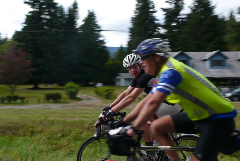
On September 5th, at 05:00, Vinny Muoneke and I set out on the Volcanic Arc 1000K, a one way ride from Federal Way, WA to Eugene, OR.  We committed to the distance and the date for this event in October of 2013 at the SIR annual meeting. Our idea was to do a mountainous ride. Let’s do a ride in the Cascades from the Seattle Area and head south to Eugene, where we can hang our bikes on a hook and ride the Amtrak Cascades train home.

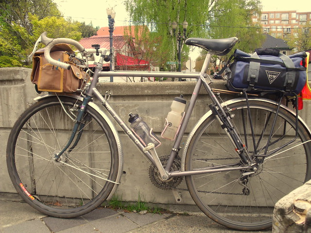
Easier said than done! Eventually, with the help of fellow randonneurs in Washington and Oregon, I designed a route and got it approved. There were more kilometers in the Eastern Oregon high desert (miles, too!) than we’d initially discussed, but it cut down on the climbing a bit and brought in more services. Even so, my Garmin reports 9915m (32,530ft) of climbing* and we had 193K without services on the final night of the ride. But I’m getting ahead of myself…

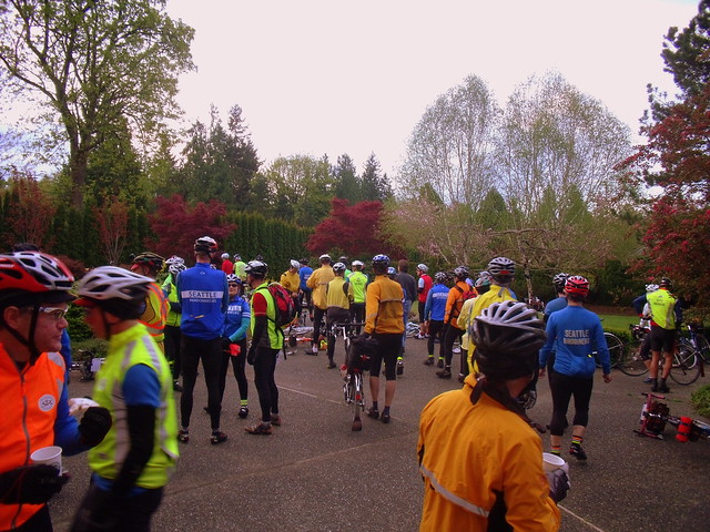
Do your best to ride a quick and efficient first day because it will pay off later. But do keep in mind that the kilometers you pedal in Federal Way and Auburn will not be fast. Early morning commuters are on a mission and may pass a bit too close, a bit too fast. So be as alert as possible for 5am Friday. And you’re likely to catch red lights. Many of them. We caught every light in Auburn. If you need something, there are services here.

Green Valley Rd

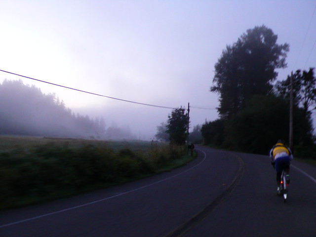
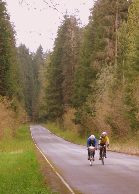
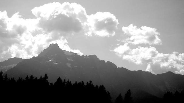
Leaving suburbia, we entered lightly foggy rural Western Washington. Car traffic died down, except for the occasional pickup and a school bus that passed us at least twice (We passed the driver stopped for a smoke break! Don’t worry, there weren’t any kids on the bus). Sleepy cows didn’t bother getting up when we passed, they just laid in the tall, wet grass as we shivered by.  Approaching Black Diamond, the road begins to roll and then climb in earnest.

Ranier

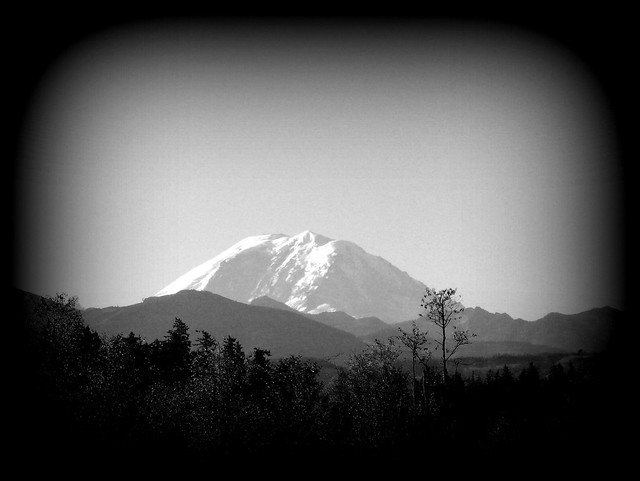
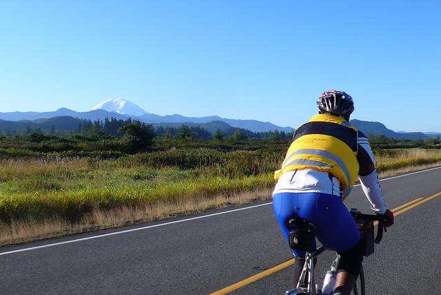
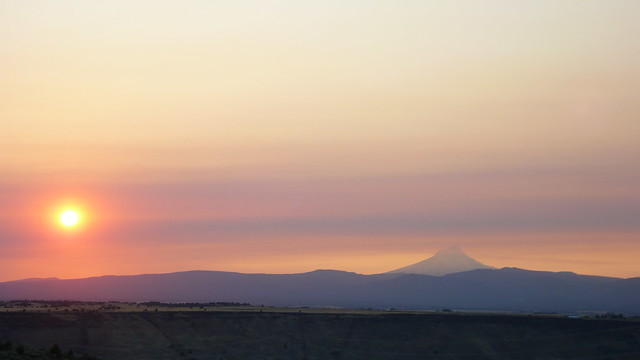
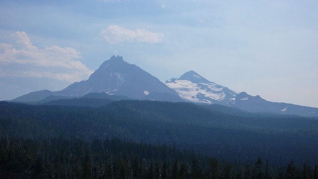
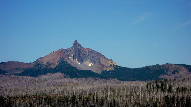
We climbed out of the fog and, unusually, it was warmer at the top of the climb than the bottom. I caught my first vista of Mt Rainier waiting for Vinny at the top of the first big climb, framed by branches. She has a lot less snow than I remember from other years, but is still magestic as ever.  Vinny caught up and we descended back into the cold, turning away from Black Diamond and into the Green River Gorge. Winding roads and a narrow bridge kept us alert (there’s an info control at the bridge, so I hope you’re alert, too!) and we were in good spirits. Vinny’s rear derailer acted up a bit climbing towards Cumberland, but our fumbling with the barrel adjuster didn’t seem to improve things terribly. I was thankful for my friction shifting, even though I’ve been toying with the idea of modernizing my components…

Narrow Bridge

The store in Cumberland was open and they told Vinny that they open at 6am, but past rides have shown him that they don’t always keep these hours. So this may or may not be a useful location for a re-supply, but the control in Enumclaw is only another 17km down the road.  Speaking of Enumclaw, the route follows the same cues here as the Cascade 1200K with a left from WA 410 onto Park Ave and a right on River Road. But on a Friday morning, that turn isn’t easy and might not be safe. You might prefer what I’ve heard alternative transportation wonks call a “Copenhagen Left” — when you reach Park Ave, cross the intersection and pull to the side of the road; now turn your bike 90deg to the left; when the light changes, cross WA 410 and you’re good.

Ranier In Distace

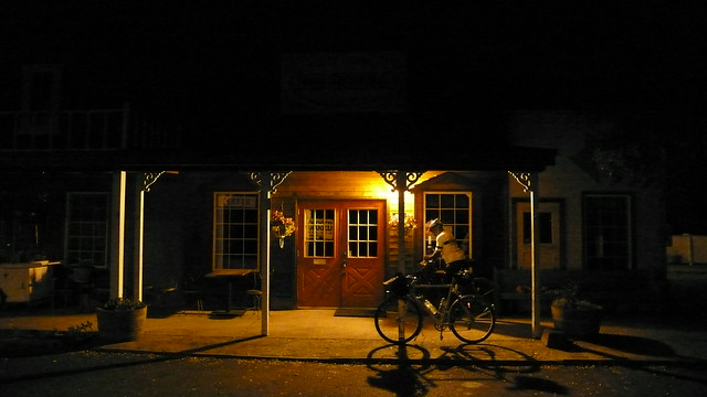
Leaving Enumclaw, you’ll take the Foothills Trail which is pleasant and direct. The only real challenge is recognizing your correct exit as there aren’t any way finding signs on the trail! I’d suggest looking at the map before riding, especially if you’re traveling from out of town and haven’t been on this trail before. After the trail, it’s some pleasant highway miles into Eatonville. We recommend the Plaza Market for a quick resupply, but the cafe is quite good and there are a few other options, including a Subway which has not demonstrated itself to be a quick control choice.

The cafe can be slow, too, so check it out before committing. A Classic Car and Porsche-enthusiast group had passed us on Orville Road approaching Eatonville. I’m not big into cars, so I can’t get too specific, but I saw several newer Porsches, a beautiful vintage Porsche, a Ferrari (red, of course), an older Mustang, an early model Ford, and a couple of zippy things that I didn’t recognize at all. They all stopped at the cafe… Oh, you’re the bicyclists! Oh, you’re the classic car group! Slightly longer line, but they got there ahead of us, so had mostly ordered already. The croissant breakfast sandwich was good and I was happy for a cup of hot coffee.

No Snow

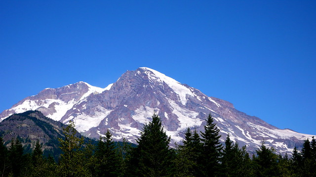
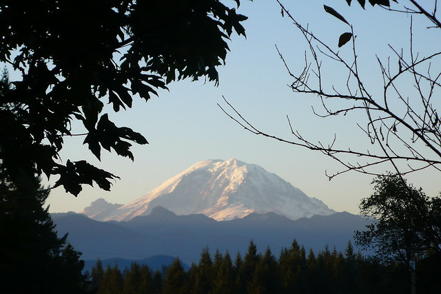
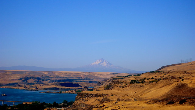
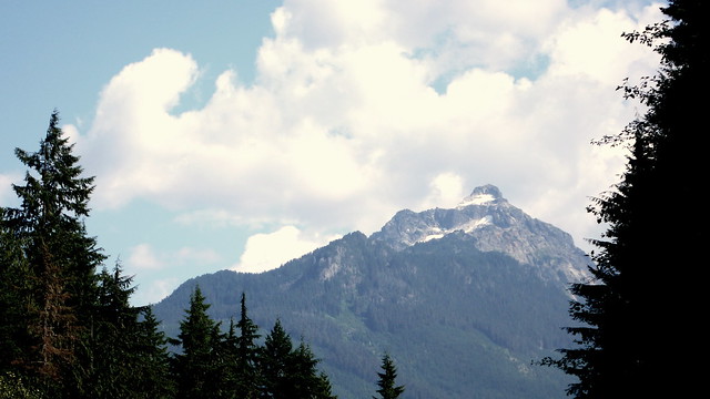
WA 7 takes you South of Mt Ranier, for some lovely views of the mountain. There are several little stores and restaurants along this road in Ashford, so be sure to resupply as necessary. I flatted here and Vinny almost lost his pump, but we circled back for it. Along the way, I noticed that the Highlander Restaurant had free wi-fi. There wasn’t any ATT cell service, so if you need to make contact or get your Facebook fix, you might check that place out.  After Ashford, you’ll turn onto Skate Creek Road, arguably the first real climb of the route. It peaks at ‘only’ 769m (2524ft), but is nicely graded and affords nice views of Ranier, the Nisqually River, and Skate Creek. The descent is quite nice and a Strava segment, if you go in for that kind of thing. We strongly suggest resupplying in Packwood or Randle, before tackling the upcoming two mountain passes.

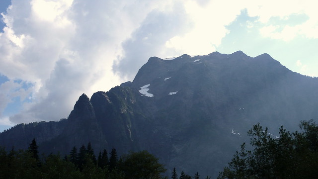
From Randle, you will take NF-25 over Elk Pass. The SIR Summer 600K (Chili Feed with Bumps) took NF-26, which Vinny calls 25’s “evil twin.” You’re welcome to go that way instead, but I’ll question your sanity.

Peak/Peek

At the bottom of the descent from Elk Pass (1217m/3992ft at the first summit – don’t be surprised by the second, slightly lower summit!), turn left onto NF-90 and cross a bridge. Just past the bridge, on your left, is the Northwoods, WA Eagles Cliff Store which is open until around 8pm most nights. We talked to the owner who vividly remembered the Cascade 1200K riders and considers Randonneurs crazy, but good customers. She told us she’ll keep the store open until 8pm the Friday night of the ride, so you should be able to resupply before Old Man Pass (aka Curly Creek Road) which summits at 2984ft (910m) rather quickly – it’s a steep and winding climb.

Mt Hood

The descent takes you into Stevenson and the first of the ‘overnight’ controls. This control closes at 04:24 on 9/20, but I’d suggest you leave no later than 04:00. I set 3 alarms to that effect, but slept through them and didn’t get us up until 3:35. From there, we went West, off-route, to visit the nearby convenience store. If you can snack from your handlebar bag, you can wait for the convenience store at the Hood River Toll bridge, or Bingen, about 20 miles into the day.

Columbia River Sunrise

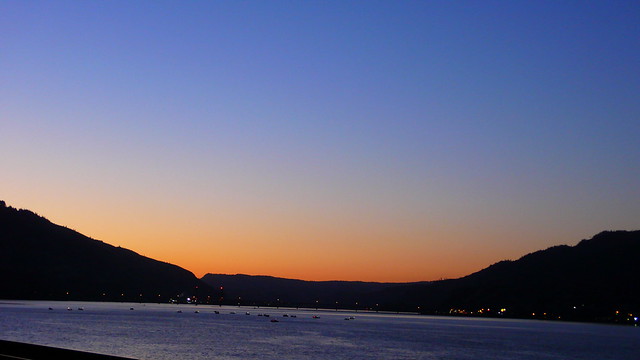
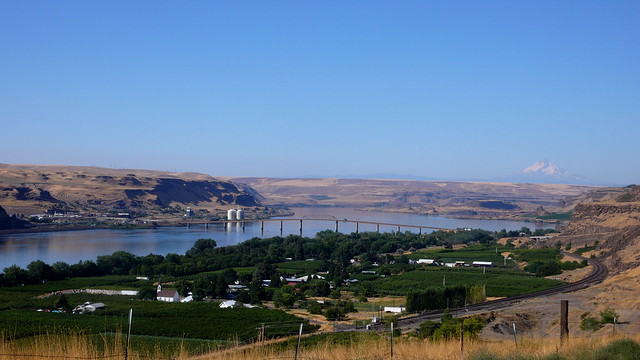
Highway 14 is a pretty road along the Columbia with good views of Oregon. It does climb a few times and you may feel jealous of flat I-84 on the Oregon side of the river, but the lower traffic and cleaner shoulder of 14 is a good trade. The road has been freshly chipsealed, so you’ll be happier with wider tires. I rode 38mm tires and Vinny rode 32mm. I was 18.75% happier than Vinny!

The other thing to know about Highway 14 is that it’s a fishing road. You’ll get passed by several pickups with boats on trailers. They all gave us room, but it’s something to be aware of. I enjoyed seeing all of the boats out on the river and on Trout Lake (to the left of the road, before White Salmon) and didn’t mind the passing terribly much. There are 5 tunnels along 14, so hit the button for bikes and alert those anglers that you’re in the tunnel. Your lights will probably already be on since you left before 04:00 (right?), but turn then on if not.

Maryhill

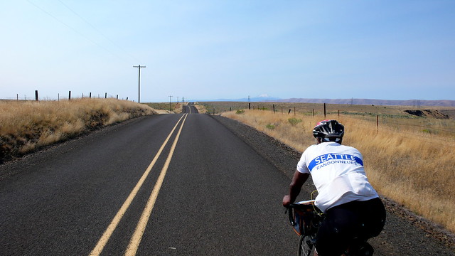
In Biggs Junction, OR, refill your water bottles and then climb the Fulton Canyon road. This will be the first of many (seemingly endless) climbs in Eastern Oregon. But hopefully you’ll reach it before the day is truly hot. We hit it a little later than is ideal and were well aware of the lack of shade. The lack of shade will continue until… Old McKenzie Pass on day 3. For this reason, be sure to take some time to cool down and rehydrate in Moro, Tygh Valley, and Maupin. In Moro, there’s a little park with restrooms and shade – a great place to cool off before climbing up to the plateau where you’ll be around 609m (2000ft) for 48k (30mi). The descent to Sherar’s bridge is winding and fast and lovely. It also got hotter as it went down to the river. The bridge crosses the Deschutes in the Warm Springs reservation where there are still platforms in the river for traditional dipnet fishing, which used to be practiced all over the Columbia before the dams, most notably at the beautiful, lost Celilo Falls.

Sherar's Bridge Hwy

The climb up to Tygh Valley isn’t long or steep, but it is hot. Hot enough that it really hurt Vinny. This is where being a smart rando is more important than being a strong rando! Vinny decided that he needed to stop for a long time at the Tygh Valley Store, losing much of the time we’d gained, to lower his core temperature and try to rehydrate. He was careful to drink not just water but to replenish electrolytes. Once his stomach settled (the heat can make you feel nauseated), he tried to eat some gentle foods. Meanwhile, less affected by the 90F+ temperatures and total exposure, I ate voraciously and waited patiently. When we arrived, I thought the ladies at the store were going to call paramedics for Vinny, he was so wrecked, but by the time we left he was practically flirting with them and, once again, looked great. So we hit the next big climb and then recovered again (less intensely) in Maupin.

Fun side note: We were on some of the same roads through this area as the Ring of Fire endurance race, but going in opposite directions. We got to see fellow SIR riders Mick Walsh and Jan Acuff on their 12-hour solo races! A pleasant surprise. Randos sure do get around.

Down Bakeoven

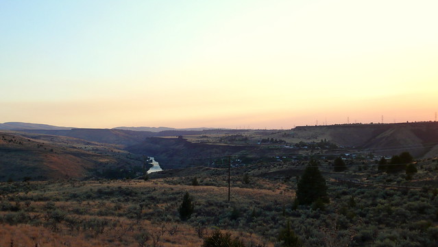
After Maupin is the threateningly-named Bakeoven Road. It looks like a steep climb with several switcbacks up a golden brown hill. And it is, but somehow, over the next 18 miles, it goes up to over 1067m (3500ft). I have no idea where that elevation comes from. It is a mountainous mole hill. There is no peak, just constant elevation gain until Saniko.

Hood Sunset

When we got to Shaniko, nothing was open. Several signs proclaimed “No Gas In Shaniko!”. Fortunately, there’s a hose bib on the park side of  Goldie’s Ice Cream Shop, so if you get in as late as we did, you can still get some water. To be polite, we reattached the hose after filling our bottles. It’s also an info control, so don’t just breeze through the town and down the steep hill to Antelope.

Ice Cream Shop Shaniko

Water In Shaniko

Antelope, population 46, was briefly named Rajneesh and, while it’s a tiny spot without much to see, is an interesting location in Oregon history. We took a caffeine ditch nap here and put on headphones (only one ear for me). The next 22k (13.7mi) are maybe my favorite of the entire route. The road trends downhill sufficiently to keep your speed high (much like a tailwind), but it also twists and is punctuated with little climbs. It was exhilarating to ride and the enormous moon (one night before full) lit up the surrounding hillsides with a gentle glow. I covered my headlight briefly with my hand and could see the road pretty well, but the light was better and made me more visible, so I uncovered it again.

When that lovely stretch of road ended, we turned onto Hwy 97 and spent the rest of the night in the fairly wide and clean shoulder. The road here gains 400m () somewhat gradually, punctuated with big hills. Unfortunately, the hills are too far apart to maintain any momentum from the descents to help with the next climb. You just have to work your way along to Redmond. On the plus side, there’s a 24-hour convenience store in Madras with a very friendly staff (Ahern’s). They were suitably impressed with out (crazy) endeavor and didn’t seem to mind our hanging around in funny clothes – though they didn’t want us sleeping on the floor. At least they have a microwave and a bathroom. And coffee!

Traffic started to pick up on 97 as we got into Redmond and the last few miles to the overnight hotel (or early morning hotel, if you’re like us) were somewhat unpleasant as a result. The shower and a few hours of sleep made up for it entirely. Vinny had mailed a box ahead with clean bib shorts and a fresh jersey, which I carried from the hotel office for him. Strangely, when we reached our room, he was also carrying a box. We were tired, so it took us a few minutes.

“Did you send two boxes, Vinny?”
“No, this must be yours, Theo”
“But I didn’t send anything.”
“Well then what is this box? It isn’t mine.”
“I don’t know. Where did you get it?”
“Didn’t you hand it to me?”
“I don’t think so. But maybe…”

Turned out to be a box of travel brochures for restocking the hotel lobby. It was heavy, so we left it in the room instead of carrying it again. Even now, writing this, I’m laughing to myself imagining the hotel cleaning staff finding the box in our room, wondering what the heck we were doing. It’s the tired little things…

Three Sisters

We woke before our alarm, about two hours after the control close – a decision we don’t regret as we easily made up the time with the slower minimum speed after 600K. There’s a Shari’s just down the highway (same direction as the route), but we turned off onto the more pleasant Canal St (b/c Old Bend Redmond Highway) and decided to eat breakfast in Tummalo at the info control.

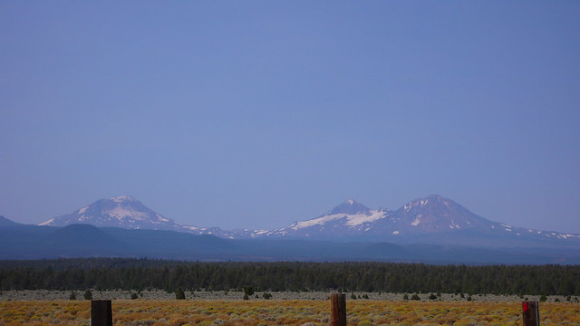
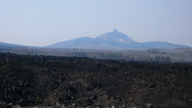
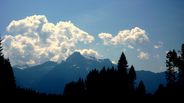
This was a pleasant, low traffic street that lost elevation and featured great views of several peaks: the Three Sisters, Little Brother, The Husband, Mt Washington, and Black Butte. I ate a giant apple fritter and drank some sports drink at the gas station in Tummalo, though I was a bit jealous of the local cyclists sitting outside the cafe – that looked a lot more relaxed and I could have gone for a nice cup of coffee. From Tummalo, the route turns onto Hwy 20 which has a narrow shoulder and a bit more traffic, but wasn’t bad. Vinny flatted just before a scenic viewpoint, so we swapped out his tube and tire under the watchful eyes of the Three Sisters (and a motorcycle tourist from Seattle).

Sisters And Brother

In Sisters, we took lunch at Bronco Bill’s which was OK. Vinny was still having trouble getting much food down and trying hard to bring his electrolytes back into balance. After a longer stop here than I would have expected, we got back on the road approaching Old McKenzie Pass and the highest elevation of the route. The temperature was in the 80s(F) at least, but not so bad as Eastern Oregon. The road is lined with beautiful Ponderosa pine, which are spaces far enough apart to let a lot of sunlight down to the ground, but provide at least some shade. Up to the Sea of Lava, that is.

Mt Washington and the Sea of Lava

Approaching the summit, I was amazed to see what looked like the biggest dumptruck in the galaxy had simply dropped a load of rock everywhere. As far as you can see, it’s just a big pile of rocks circles by volcanic peaks. I wish John Pearch has been on the pre-ride because it would have been great to have a geologist on hand here.

McKenzie Pass Summit

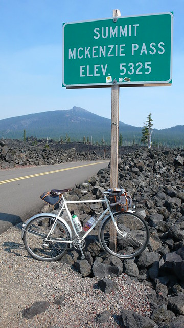
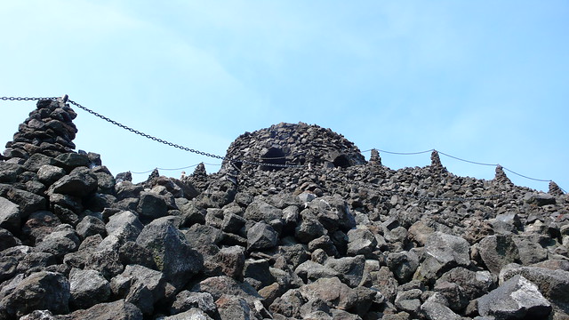
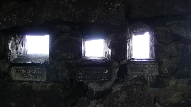
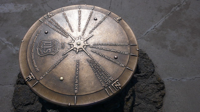
At the summit, 1,623 m (5,325 feet), the Civilian Conservation Corps built an observation post out of the most readily available material – lava rocks.
It has little windows framing each of the surrounding peaks for easy identification and, on the upper observation platform, a giant brass compass built at Portland’s Benson Polytechnic High School indicates directions and locations of each peak, as well as the height of the summits.  Waiting for Vinny at the top, I chatted with a local rider who I’d passed on the climb. He takes his Cervelo by car to McKenzie Bridge, rides to sisters for lunch, picks up a pound of coffee, and rides back. Seems like a great day ride.

Dee Wright
Peak Windows
Compass

Vinny caught up and led us down the descent – and what a decent! 55km (34mi) of downhill, much of it winding, well shaded by dense tree cover, and with corners that allow for minimal braking. There were some tight turns and I did slow down, but an experienced and confident descender could really make up some time here.

At the bottom, you’ll turn onto highway 126, which parallels the McKenzie and Blue Rivers. There are several places to resupply, from convenience stores to restaurants. If you pass Takoda’s Restaurant without stopping anywhere for food or water, you’ve gone too far! Go back, and get something. If you don’t need it now, you’ll be thankful for it later because, unless you’re wicked fast, everything between here and Eugene is going to be closed. That’s 193k (120mi), including a climb to 1142m (3747ft), without services. We didn’t fill out bags with extra food and, riding through the sleepy town of Oakridge, we were hungry and sad to see every business closed. Learn from our mistake, don’t make it for yourself.

Cougar Resevoir

Turning off 126, you’ll be on NF19, aka Aufderheide Dr, which would probably be a lot more fun in the opposite direction. The climb is steep at first, mellowing at the Cougar Resevoir, but goes up in stages, including a rather steep stretch near the top. At the summit, 1142m (3747ft), I pulled on some layers, put my rear light on blink, placed it on the shoulder facing downhill, and pulled myself and my bike off the road for a ditch nap. I don’t know how long I was out before Vinny came by. He told me there was no way he would have missed me there, but I had paranoid dreams of him riding past and waking up hours later, after the Eugene control was closed, and having to ride home with a DNF and no breakfast.

The descent is what I’ve heard called a “pedal, pedal descent” and is not nearly as fun as coming down from McKenzie Pass. I found it disorienting in the dark and couldn’t always tell if the road was rising or falling. I felt like I was coasting uphill with a tailwind and pedaling downhill. Headlights down the road looked like they were at the top of an impossibly steep climb, but the road turned out to be flat. Maybe I didn’t take a long enough nap at the summit.

We were happy to reach Westfir, even though that just means there’s one more steep climb before Oakridge, but at least we’d made it down the Aufderheide. In Oakridge, we ate the last of our food in front of the post office and then searched for an open business on Hwy 58. We didn’t find anything and pulled over in front of St Vinnie’s (!) to put on more layers – it was getting cold and much of the rest of the ride is downhill (not entirely, sorry) – and took an impromptu ditch nap. Vinny had the good sense to lay down, but I fell asleep sitting up and woke up with a stiff back. So it goes.

The shoulder on 58 is narrow in places and cars drive faster than they should, so be very cautious. If you’re sleepy and swerving, get off the road and sleep. Remember that it doesn’t matter if you get in under 74hr 59min; safety first. If you’re wicked fast (as in getting to Oakridge when businesses are open), there may be more traffic, so you’ll need to be even more cautious than those of us who reach this point in the ride late at night. Everyone gave us excellent room while passing, but there were mostly professional truckers on the road.

Fires earlier in the day left the air through this area thick with smoke and stinky. Signs proclaimed “fire activity ahead,” but the fire must have been out or sleeping, because we didn’t see any activity. Hopefully there won’t be any significant fires for the brevet weekent.

Turning off of 58 in the Dexter/Jasper area, the landscape suddenly resembled the beginning of day one, with sleepy cows and horses and a light mist over the road. It was similarly cold, too. We were pedaling slowly and, even with all of my layers on, I was shivering. On the first of two bike path sections, Vinny was mesmerized by the winding path and had trouble with his focus, I drifted ahead and met a young coyote who let me coast to less than 3 feet away before turning to run into the brush. The Middle Fork of the Willamette river rushed along beside us, reflecting moonlight through the trees.

In Springfield, you’ll return to city streets briefly before returning to bike paths. I’ll give the cues a careful going over and will provide a little map for riders because, as Eugene-local Michal Young describes it, the path is like a river delta, with little branches going everywhere. You’ll mostly bear left at the forks, but it still gets confusing. Eventually you’ll reach a little red suspension bridge over the river and then it’s just a few turns to the finish. We stopped to wait for a long freight train at just about 6am. Two hours until the control close. Vinny turns to me and says, “The fates are still trying to make us DNF this ride. How long is this train, anyway?” Fortunately, we were towards the end of the train and it was only a few minutes delay.

At the hotel, we rang the night bell and the manager was surprised to hear us ask to check in for our Sunday night reservation. We told him we’d come down by bike from Seattle and he offered us a late checkout; we accepted. Finally, we got more than 3 hours of sleep. Protip: there’s a Buffalo Exchange just a few blocks away where we bought some canvas shoes (bike shoes off!) and casual clothes. I even found a nice denim shirt so I could pretend to have some fashion sense.

Michal Young rode to the hotel to meet us around 11am and we walked into town for lunch and tall tales. A few hours later, we were sleeping on the Amtrak Cascades train, headed North, headed home.

Lunch in Eugene

*Vinny’s Garmin was reporting twice what mine was on the third day of our ride, but I suspect Strava corrected for errors as this is close to the RWGPS estimate. Imagine it as 10000m to be safe. You won’t regret overestimating the climbing on this course!

The Crash

The Crash

In May of 2011, I headed up to Seattle on the Amtrak to ride my first 400K. Just the week before, I’d done my first 600K in Oregon, where I met Vinny Muoneke at breakfast on the second day at the Siletz Cafe. He’d encouraged me to come up, stay with him, and ride – any time. I decided to take him up on it.

On my way to the train, I stopped by a bike shop to have a mechanic take a look at my Shimano generator hub, which had been making terrible noises on the 600K and had subsequently sprayed red grease all over my wheel. The mechanic asked when I needed the work done. “Well, I am catching a train in a couple of hours to go to Seattle and ride a 400K. So if you can’t fix it now, I’ll bring it back after.”

Packed for the Flèche

He refused to let me ride without servicing the hub and immediately stuck the bike in a stand. I nervously watched the clock while he opened the hub, cleaned it out with a rag, checked the bearing surfaces, and then loaded them with red grease and ball bearings. He slid the center of the hub back into place, finger tightened it, grabbed a huge wrench and… broke off a chunk of the hub!

We shared a look of horror. The cheap metal that Shimano used for the hub had simply cracked off with the force on the wrench flat, exposing a surface of mottled grey and silver. Thinking quickly, the mechanic took the central part out of a brand new Shimano generator hub – the updated version of the same model – and fit it into my wheel. He charged me for grease and bearings and sent me on my way. I thanked him and bolted for the train, just registering a strange, sticky feeling in my front brake lever as I scrubbed speed at stop signs. I had to flick the lever away from the handlebars after braking… But no time for that – the train was going to leave!

The train was an hour late to Vinny’s, but we headed out for Pho anyway. He warned me against his choice of Ox Tail (“An acquired taste,” he said), but was sufficiently impressed when I chose the house combination bowl with flank steak, tendon, tripe, and meatballs. And again when I finished the entire large bowl.

We enjoyed eating and talking together before heading back to his house, where he set me up in a guest room for a few hours of sleep. At one point, I remember waking up to hear a vacuum running… Vinny wasn’t sleeping at all. I got up shortly thereafter and we loaded my bike on the the hitch rack of his truck and drove to Redmond for the ride start.

SIR Brevets are Big!

I had never been to such a well-attended brevet! A PBP-year spring 400K in Seattle is a sight to behold. I bounded around the start like a pinball, social butterfly that I am, finding familiar faces from the last two Flèche rides and SIR riders who had visited Oregon. Finally, it was time for the pre-ride announcements. And then, we were off.

Still excited from the start, I hurried down the road, looking for someone to with whom to ride. For a moment I was next to John Pearch, with whom I’d done most of an Oregon 200K earlier in the year. Ahead I saw a few other familiar riders and sped up to catch them as they went around a corner and down a steep hill.

John Pearch

I reached the top of the descent with too much speed and then fearfully notices a bend at the middle of the hill and off-camber turn at the bottom. The asphalt was damp from the previous night’s rain. I pulled my levers to scrub speed, but that sticky lever failed to release. The front wheel locked and slid out from under me. The bike fell and I landed on my left side, arms out like superman. Quickly I was on my stomach, facing down hill. My feet were going faster than my head, so I spun 180 degrees. My bike bounced off the left side and impacted again on the driveside. My handlebar bag flew away, ejecting its contents. My waterbottles came out. And everything, including me, ended up in the wet ditch at the bottom of the hill.

Later I would see that my computer recorded a top speed of 47mph.

John Pearch and another rider stopped and pulled me out of the ditch, then helped to gather my things.  They looked at me with shock and anticipation. I observed my bleeding hands, torn up clothes, and broken brake levers and knew, 2.5 miles in, that my ride was over. I assured them that I would be ok, encouraged them to go on ahead and, when they left, called Vinny.

“Hey, Vinny, did you leave Mark’s house yet?”
“No Theo, I’m still here. Why?”
“My ride is over. I crashed and my bike is wrecked. Can you come get me?”

Vinny figured out where I was and told me to wait. A while later a woman in an unfamiliar car pulled up.

“Are you Theo?”
“Yes…”
“I’m Chris Thomas, Mark’s wife. Let’s get you in the car and back to the house.”

Chris sent me inside where Vinny grabbed my arm roughly, looked at my abrasions, and said “superficial.” They sent me to the shower.

When I came back downstairs, Chris tried to patch me up, but her bandages were too small for a few of my scrapes. It would have to do. I told Vinny that I wanted to join him as a volunteer on the course as I wasn’t about to waste my travel money to sit around feeling sorry for myself.  Since the ride would finish at the Chris and Mark’s house, we left my damaged bike there and I climbed into the truck with Vinny.

Vinnie

Along the way to Baker Lake, we picked up some NSAIDs at a convenience store.  Vinny told me I was going to be very stiff and very sore. He was right.

When we reached our destination at the tree-lined lake, there were already several volunteers there, including Jennifer Chang, Kole Kanter, Hugh Kimball, Kevin Humphries and Kevin’s young son. Vinny set up the tables and chairs he had in the truck and we loaded them with snacks and water. Under a popup tent, Hugh heated soup. While we waited for the riders to come in, I hobbled down to the lake to admire the rugged mountains and staged a self portrait for which I could not quite manage to stand up straight. That slight lean was with me for weeks.

Jennifer, Kole, and Hugh

Me at Baker Lake

In less time than I would have expected, two randonneurs appeared in the distance. One blue dot and one yellow. As they approached, I saw that they were tucked deeply behind their handlebars and moving very quickly. They were Jan Heine and Steve Thorne.

Jan and Steve

There could not have been more contrast between them – unless one had been on a recumbent, or possibly a skateboard. Jan rode an old, grey Alex Singer with leather saddle, non-aero levers, and a weathered canvas handlebar bag leaning far forward from the bars. He wore a wool SIR Jersey and wool hiking socks. Steve, in a modern lycra jersey emblazoned with the Cal logo of UC Berkeley, rear pockets bulging with gear, rode a full carbon road bike with lights clipped to the handlebars and bright pink bar tape. But they rode together, smiling and breathing hard from the effort of the steep climb up to this control.

Steve and Jan

They stopped a while, despite plans to finish the ride as quickly as possible. Jan drank a bowl of tomato soup, saying, “Soup is good. The French randonneurs used to carry a thermos of soup on their rides.” I won’t deny that his vintage bike, fast riding, and stories about the early French randonneurs captured my imagination. I wished that I was riding with them. Instead, I hobbled around the parking lot at the lake, taking pictures.

The next few hours were a blur of activity as riders showed up and I signed their cards and took their pictures. Some of them dashed back out onto the course quite quickly, others sat for a long time, chatting and eating. The deep feeling of camaraderie and friendship among the SIR riders filled me like a helium balloon and I drifted above the pain, fatigue and disappointment with my failed ride.

Chris and John

Rick Blacker

Happy Canadian Couple

Eventually, everyone cleared out and I woke Vinny from his “ditch nap” in the passenger seat of the truck. Along with the other volunteers, we packed up and left the parking lot as clean as it had been when we arrived that morning. When I got back into the truck for the drive to Redmond, I finally began to feel the pain of my crash.

As we drove South, it started to rain. A lot.

Back at the finish, Chris was making dinner for riders and we started another round of waiting. Vinny told me when he expected Jan and Steve to arrive soon, but I couldn’t believe it. How could they finish a 400K course in 16 hours? It seemed impossible.

Ultimately, Jan finished in 14 hours and 52 minutes; Steve in 15 hours 46 minutes. But neither was fast enough to avoid the heavy rain.

Outside, the sky was dark and rain came down in sheets. Each rider arrived more soaked than the last. But their spirits lifted with the word “dinner,” and they went inside to join the crowded table, where conversation was loud and happy.

Mark's House - Finish

A few riders came in bloodied by crashes in the last few miles. A rough patch on a nearby road was hidden under water and darkness, catching riders by the wheel and pulling them down.

Mark prepared an alternative route, printed many copies of the short detour cue sheet, and I headed out with Vinny to see if we could find the remaining riders and spare them from riding the treacherous road.

We went back to the last control, a convenience store, and didn’t see any riders. I left several copies of the updated cue sheet with the cashier. Then Vinny and I tried to drive the end of the route to intercept anyone between the control and the finish. Unfortunately, we didn’t have our own copy of the route sheet, so Vinny had to navigate by memory and, in the dark and rain, the roads didn’t look the same. He wasn’t sure we were on route the whole way.

Back at the finish, we waited on the last riders, hopeful there would be no more crashes. I felt exhausted. A call came in that a rider had crashed into a post on a bike path and would not be finishing the ride. Another call: the happy Canadian couple (photo above) had abandoned when the rain became unbearable. Finally, a rider came in with a smashed helmet. He staggered a bit and said that he had gone down in the last few miles. He hadn’t seen the detour sheet and we hadn’t seen him on the road.

Feeling bad for missing that last rider, Vinny and I decided it was time to go home. It was 1 am and we’d both been awake for far too long. I tried to load my bike onto the hitch rack, but it didn’t seem quite right. Vinny made a face, but didn’t say anything, so I figured it was okay. Within minutes of starting the truck, I found myself falling asleep. I struggled to stay awake in solidarity as we drove down the highway to Tacoma, rain pelting down and deep standing water on the road. My eyes closed on their own, and, after what seemed like only a heartbeat, I awoke to Vinny saying, “Shit!”

“What?”
“Do you see that?”
I look back behind us into the dark and see nothing.
“No…”

Vinny pulled over immediately. As I woke up, I realized that “that” was my bike and the reason I didn’t see it was that it had fallen off the hitch rack. We got out into the rain and walked to the back of the truck. I felt, suddenly, very awake. The safety strap on the rear wheel held and the bike was hanging off the rack. The handlebars had impacted first and some pieces of the brake levers had been broken off. When that happened, the bike bounced and the bars turned such that it returned to the ground on the front fender and the stem – no other part of the bike touched down. A huge hole was worn into my metal fenders and the top corner of my stem was gone, ground away by the road. Vinny mounted the bike back on the rack, securely this time. We headed home to sleep after a long day.

Sad Bike Heads Home

The following weekend, I tried again, heading to Eastern Washington with my friend Susan Otcenas for the Desert River Randonneurs 400K. But that is a different story entirely.

SIR Summer 400K

001

Standing around with 34 other mildly cold, brightly dressed randonneurs under I5 at the Green Lake Park and Ride in Seattle*, ride organizer Jeff Loomis started us off with some invaluable advice – if you don’t want to get lost on the Interurban Trail, follow someone local. Adam Morley made some quip about getting lost on the trail the last time he was out and Andy Spier and I simultaneously call out, “Don’t follow that guy!”

Fortunately, Audunn Ludviksson finds his way to the front with Joe Llona and the rest of us can stop thinking about navigation. I fall into conversation with Richard Wolf about traveling in Europe and India and his audax-style rides with MUC Montpellier.  I’ve never done an Audax ride, but they sound interesting. Everyone stays together in one group and a maximum pace of 22.5km/h is maintained by the capitaines de route who are responsible for the peleton’s pace, safety, and decision making. And you can’t pass them.  You can read the rest of the rules here in fairly simple French.

There was, eventually, some confusion about the route along the trail and everyone but Joe Llona stopped. I figured Joe knew where he was going, but the group turned around and took the road – we could see Joe flying downhill into the foggy valley as we waited at a stoplight. Joe’s son Jesse picked up the pace to catch his dad and I lept for his wheel. Pretty soon we were going 25mph and I was feeling le goût de l’effort in a very good way.

At the bakery in Snohomish, Joe ordered a double espresso and a chocolate croissant. That sounded good to a few of us in line behind him, so we ordered the same. I guess Joe was our capitaine de café.

002

I didn’t feel like sticking around too long, so I left the bakery with Richard and Chuck Mangold. The fog had burned off the valley and we set a moderate pace on the Centennial Trail where quite a few people were out to enjoy the tail end of summer. Eventually Steve Frey caught up to us and we sped up a bit to keep with him. By Arlington, we had a fairly large group, but most of them stopped for water and a bathroom. Steve and I kept rolling and, with fewer people on the path and no one to avoid on WA-9, were holding steady at about 20mph.

The turn onto Finn Settlement road felt like the authentic start of the ride, to me. Everything up to that point was familiar and dominated by multi-use paths. But after this turn, the roads started to roll and twist and the fun really began. We spun up the hills and descended in our aero tucks. My new Garmin Edge 500 was getting in the way of my left hand and I was trying to figure out how to grip the bars in a more effective way without sticking out my elbow. Steve has a computer in the same spot and holds one hand against the stem, but I didn’t feel stable that way.

As we rode in the dappled shade of the Maple trees and past farms, we ended up talking about tires, riding technique, and some of Jan’s theories. When I wondered aloud how to get another 3 hours off my 600K time to break 24 hours, Steve mentioned that Jan, in addition to riding fast, works to be very efficient through controls. I don’t tend to stick around controls for an excessively long time, but later in the ride, approaching Barlow Pass, I decided to see just how quickly I could get through each stop for the rest of the ride. It was a fun challenge and I ate more on the bike than off.

“Hmm. I seem to be having a bit of a mechanical,” Steve tells me as we crest a hill. We pull over and he sees that his non-driveside bottom bracket cup is threading out. A crank puller and BB tool are not typically carried on a ride, so there’s not much we can do. He adjusts his front derailer to make up for the migration of the spindle and we continue riding. Soon we’re pedaling at a steady clip with the Skagit river on our left and a canopy of broad maple leaves above us, ignoring the issue and enjoying the ride.

003

At the control in Concrete, though, Steve finally decides it’s a better bet to head to Mt Vernon in search of a bike shop (and then home) than to head deeper into the mountains with a BB coming out. We drink some soda (I find some root beer with 270 calories in the bottle – just what I need to stave off bonking after not eating enough early in the ride) and wonder who drinks this crap regularly and in great quantities. Right then, a guy comes out of the store with two boxes of soda, loads them into his car, and drives off.

After about 20 minutes I decide to leave and, at the same time, Ward Beebe pulls into Concrete a little ahead of a group of riders. That was the last time I saw other randonneurs until the finish. I pedaled along the Sauk river, trying to keep a high cadence (80-100 rpm), enjoying the rising temperatures and the mix of maples and increasingly many conifers as the elevation increased. At one point there is a fork in the river where a white branch flows into a blue branch, it made me think of the “Meeting of the Waters” in the Amazon River (which I’ve never seen in person).

004

I decided to skip Darrington as I had enough food to make it to Barlow Pass. A girl with a garage sale sign and a cigarette (was she really old enough to smoke??) called out to me, “How far are you riding?” “250 miles!” “Shit!” Other than getting yelled at and flipped off by a truck on the way up to Barlow Pass, I didn’t really talk to anyone else. Not much of a day for conversation, but I enjoyed the solitude.

The 14 miles of gravel winding up gently to Barlow Pass was well compacted and didn’t have too much washboarding or potholes, though it would have been a lot harder at night. There were quite a few cars driving on the narrow road and I got a lot of dust in my eyes and mouth. It was unpleasant and made it a little hard to see where I was going. Still, I was able to reach nearly 30mph on some of the brief descents and still corner with confidence.

The tree cover was thick and my Garmin kept alerting me “Off Course” followed by an immediate “Course Found.” With only one road to choose from, I wasn’t worried about it. Occasionally the tree cover would break and, every time, there would be an incredible mountain vista. I stopped several times to take pictures. By the end of the ride, I realized that I’d only taken pictures of the mountains! Finally, in the last quarter mile, the road picked up all of the elevation (I wondered why it had been such a mellow climb) in one steep pitch that really got my heart going.

I nearly missed the control at the summit of Barlow Pass, but Peg called out “S I R?” and so I turned around before doing any regrettable descending. She made me a delicious sandwich and Kenny confirmed that I was the first rider in. I packed half of the sandwich – it’s hard to eat a lot after a fast climb – and drank another soda before taking off. The descent had some scary pot holes and I worried for the riders who would be here in the dark. As it turned out, one rider did crash on the descent and decided to end his ride, though, fortunately, he was not seriously injured.

The majority of the descent was nice enough and I was in an aero tuck for a lot of it, though the Garmin Edge 500 was still in the way. I glanced at it and noticed a warning about auto-power down. Out of battery already? I plugged it into the backup that I’d borrowed from Vinny and the device shut off! I unplugged it, turned it back on (44% battery remaining) and could not resume my activity, nor load the course from the current location! Frustrated, I threw it into my handlebar bag.

Talking to Adam Morley after the ride, I decided to buy a charger that has a cable tip with no data pins – apparently this will charge the Edge 500 while riding without interrupting the activity. If that doesn’t work, I might go back to no computer at all. Still, seeing the distance until my next turn was nice and reduced the paranoia of missing unmarked roads. And I liked seeing that when my cadence drops below 80rpm, speed suffers – regardless of gearing or grade. It encouraged more efficient riding and I don’t feel like I spent too much time staring at it. We’ll see…

005

Riding the steep hills before Sultan, I was treated to some incredible views of mountains backed by pink sunset skies. A mother was out taking photos of her children against this backdrop. As I passed them, I said, “It’s incredible.” And then I worked hard on the hills, singing Dire Straights, determined to reach Sultan before dark.

In Sultan, I dashed in and out of the Chevron in a few minutes, put on my reflective vest and ankle bands, turned on my lights, and was back on the road. Ben Howard road was beautiful in the dusky light, curving along the river, no traffic. At the turn onto WA-203 it was finally dark enough that I needed a light to read my cuesheet. I fished my frenemy the Edge 500 out of my bag and started it again, accepting the zero distance reading and decided to simply calculate the new distances for each turn based on the display plus the leg milage. That mostly worked well, except for a twisty descent in Woodenville where the road changes names a few times. I had to pull over to read the sheet, only to discover that the next three cues essentially said ‘stay on this road as it twists around down the hill.’ So much for making up for speed lost climbing up the other side!

I got a little lost twice on the Sammamish River Trail due to poorly calculating what the garmin should say before the “sharp Y” where I would then find the Burke-Gilman Trail. And I missed another turn while looking for community gardens on Ravenna – I went right past NE 77th St and had to turn around. But the delays were minimal and I pulled into Jeff’s backyard at 11:13PM for a total time of 17 hours 13 minutes. I drank a beer, ate some hot dogs, chatted with Jeff, and waited for other riders to arrive.

My favorite thing about staffed brevet finishes is that I get to see the other riders. With food and drink and company, people stick around, and you get to see people who finished before and after you did. It’s a great opportunity to build on our sport’s spirit of camaraderie and I really enjoy seeing my rando buddies. I stuck around for about 3 hours until Vinny arrived and then we drove back to his place in Federal Way for a couple of hours of sleep before heading off on our next adventures.

Route: http://ridewithgps.com/routes/5658541

Results: http://brevets.seattlerando.org/events/results/312

Strava: http://www.strava.com/activities/186292376

Olympia 300k Preride Report

by Ian Shopland

This ride links some of the most scenic, quiet, least travel roads in southwest Washington. Even in the pouring rain, I was amazed at the solitude and beauty. Here is my ride report:

Olypreriders
Photo by John P.

Four riders: Theo, John P, Corey and myself huddled in the Starbucks and watched as the morning dawn never came. Black clouds billowed out of the south and blocked all but the most faint of morning light. The umbrella awning outside the door spun like a top in the wind and sprayed water over us like a rotary sprinkler. We hardened our resolve and pulled ourselves away from the pastries and coffee.

Within the first few blocks, the route kick up and climbs over Tumwater Hill. It felt good to get blood pumping in the cold rain. Our brake pads squeegeed off water from our rims on the descent as we rode through sheets of water on the road. We snaked through the westside of town, taking the back roads to stay off the freeway as long as possible. Just before the gas station at Steamboat Island, we turned onto the 101 onramp and headed north to Shelton. This is the busiest section of the route but the shoulder is wide enough to ride two abreast. Be cautious when crossing the on/off ramps. Just north of Shelton we spotted some patches of blue sky and then decided they were actually just patches of less gray sky. Before too long we were a the first control and filled up with snacks and more coffee.

The instant we turned off 101, the sound of traffic disappeared behind us and we were left to our thoughts on the small roads though the woods. The next info control is not far off, but takes us through the quiet valley of Little Egypt. I believe this road is new to SIR. This info control is at a bridge between mile marker 1 and 2. Don’t forget to stop and read the sign on the left. After the control, the route circles the valley and the next turn isn’t signed. It turns up a short unmarked intersection that is a connector to the main road (Highland). If you miss it, just go down the 200m to the stop sign and take a left on Highland. It gets you to the same place.

At this point, the rain had nearly stopped and we were able to look around and enjoy the scenery: green leaves slowly unfolding, rippling creeks full to their banks, and bright yellow odorous skunk cabbage blooming in the ditches. As the route turned south, the winds picked up and brought driving rain with them. This would be the weather rhythm of the day. Patches of dry/almost sunny and then the water faucet would reopen and we would be soaked for a few miles.

We arrived at the Montesano Thriftway dripping and were thrilled to see the deli was open. Hot chicken strips and hot clam chowder made the perfect lunch meal. The break was much needed, but we spent a long time there trying to work up the motivation to go back into the rain.

The stretch between Montesano and Artic went quickly. I was glad we didn’t have to go all the way down to Raymond on the “normal” route south. I’ve heard the cafe called “Clark’s” is very good and is located just before the turn, but we didn’t stop. The Fire station is just around the corner from the turn off on 101. The answer to the info question is on the west side of the building, (that would be the left side when looking at the doors).

WeatherStation
Photo by John P. who said “The weather was all over the board.”

Our first real sun came out a the perfect time. The trees and bushes were dripping with diamonds of raindrops as we followed the North River on the only paved road to the town of Brooklyn. The tavern here is a legacy of the logger bars of the yesteryear of the region. The wood floors and well worn and the walls are covered in old logging tools. We walked into a live duet of tuba and piano serenading the locals. The bartenders were happy and welcoming and the there were drinks and hotdogs within a few minutes wait. It was hard to leave the warmth and entertainment of the bar but the most difficult sections of the ride were about to come.

IanBrooklynRoad
Photo by John P.

In less than a mile the beautiful paved road turns to gravel and begins to climb. It continues for 3.8 miles and gains 800 ft with a max grade of 12-13%. The gravel quality of mostly very hard packed. The climb is long and hard but the views are incredible. If you can hear your heart pounding in your ears, just stop for a moment and regroup. Walk a bit and try again. The descent is also steep 11-12% and looses about the same elevation in about the same distance. Keep your bike under control and and don’t overstep your skills. Make sure you are having fun. Before you know it, the pavement starts again and before you know it, there is another steep (paved) climb ahead of you.

The next stop was Adna and we warmed ourselves again and were ready for some food. I warmed a burrito in the micorwave and John heated up some canned soup in a coffee mug. PLEASE pick up after yourself. The manager Jason wasn’t happy that some rando’s left garbage on his table and outside on another ride. Be courteous and clean up and remember thank yous.

Don’t eat too much in Adna or you might taste it again as you are going up Curtis Hill, just a few miles from the control. Darkness fell as we crested the hill and on the descent, we were again pelted by rain so hard it stung my face. The Curtis store is closed, but the answer to the info question is on the building to the left of the door. The route heads back the way you came, but don’t worry, we’re not going up Curtis Hill again. The route turns right on Lake Creek and heads down to King Road.

KingHill
Video of King Road by Corey Thompson

King Road was one of those roads that Randos have passed on many rides and I always asked myself, “I wonder where that goes?” It is a beautiful road that connects Curtis to Winlock. The pavement ends long before the climb. The climb itself is less than two miles but it is steep 11-12% and gains 600ft. This gravel is looser than on Brooklyn Road. Riders with 23mm tires will be challenged to maintain traction at times. The reason we started the ride an hour earlier was to get most of the riders through this section in the daylight. Our journey put us through this section put us through here in the pouring rain in the dark. It was a serious challenge. Most of the descent is paved, however. There is a short steep section of gravel (.6mi) and 8-9% max grade and 150 ft down.

You almost don’t have to pedal to get to Winlock. The usual bridge on Fir St is closed so there is a short detour south one block to the next bridge. After a re-supply on food, coffee, and dry air. We began the final section of climbs. The route backtracks a few blocks and zig zags through town to Tennessee follows a few roller coaster hills before you hit Pleasant Valley. The only thing unpleasant about Pleasant Valley is leaving it, but before too long the Hillcrest Food Mart appears.

At this point, the hills were over, the wind was at our back but the rain still pounded the pavement. We headed north to home wet and tired.

Hope to see you on Saturday morning [5 April 2014].

[Ride details are on the SIR website. Route is on RideWithGPS. – Theo]